Aerial Robotics
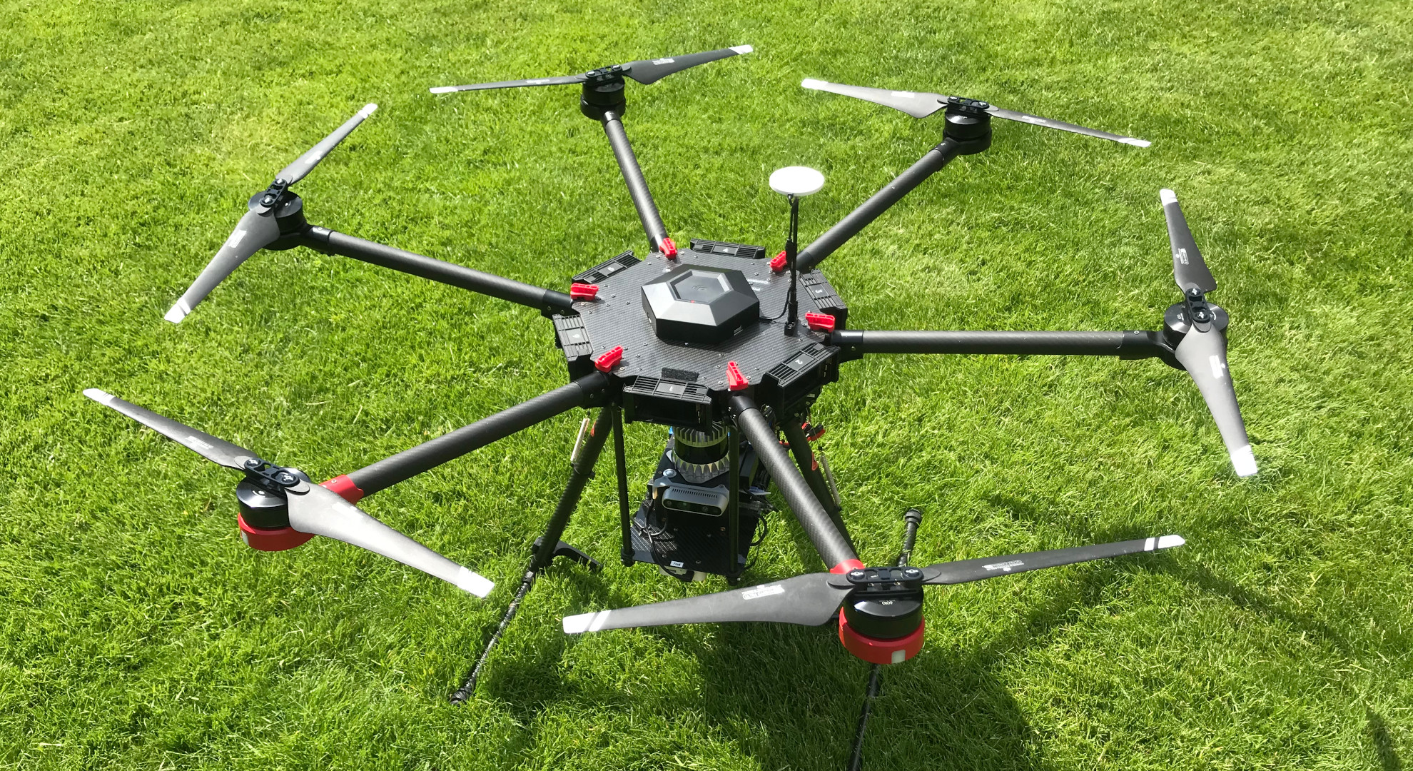
Our aerial robotics research focuses on navigation and mapping with the challenging motions and failure cases we have while flying - particularly without relying on GPS. Our aerial platform combines our Frontier multi-sensor payload integrated on our DJI M600 drone.
Osprey: A Complete Multi-Session Autonomous Aerial Mapping System
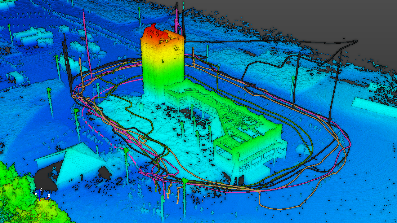
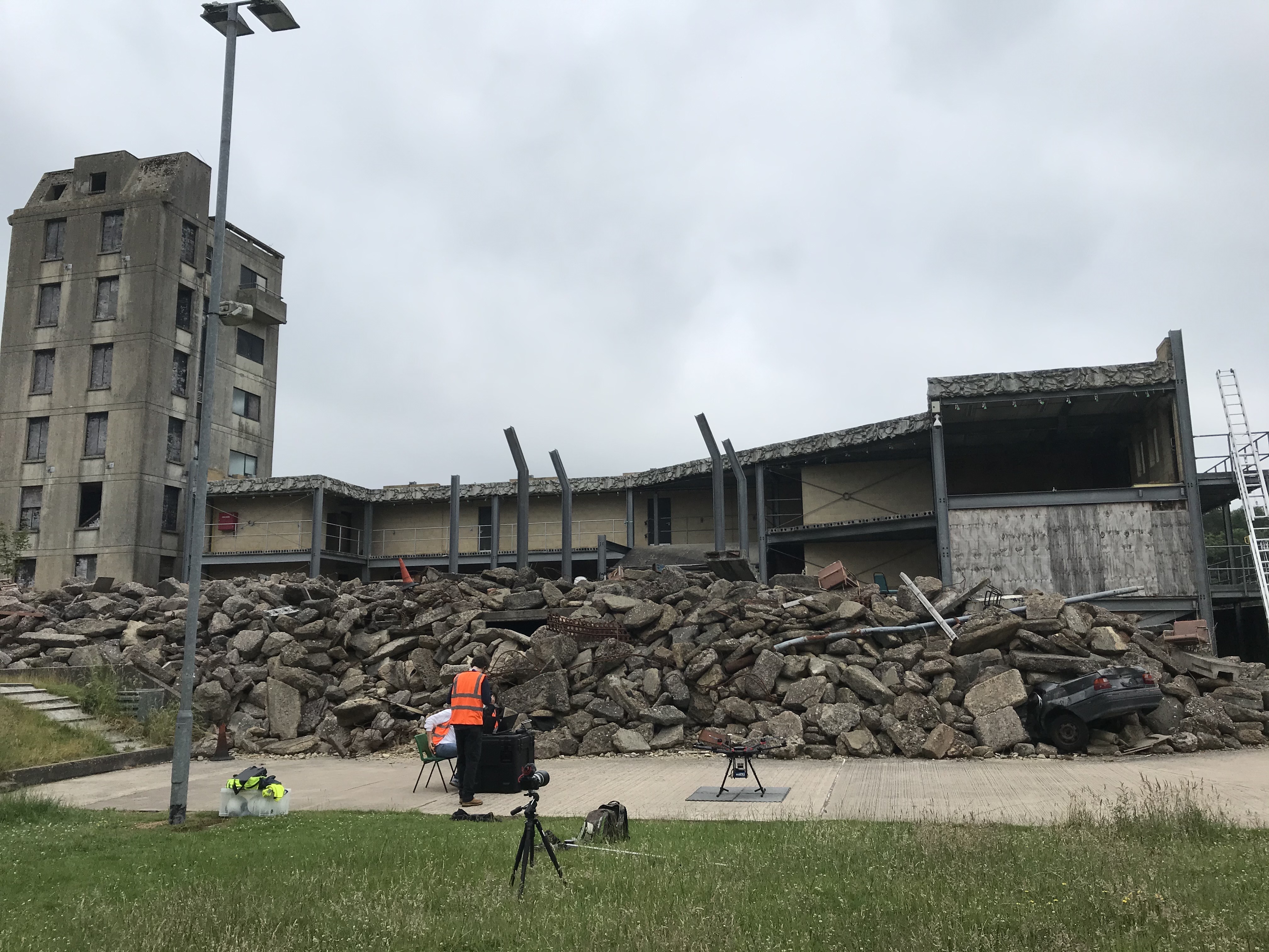
Abstract: Aerial mapping systems are important for many surveying applications (e.g., industrial inspection or agricultural monitoring). Aerial platforms that can fly GPS-guided preplanned missions semi-autonomously are already widely available but fully autonomous systems can significantly improve efficiency. Autonomously mapping complex 3D structures requires a system that performs online mapping and mission planning. This paper presents Osprey, an autonomous aerial mapping system with state-of-the-art multi-session LiDAR-based mapping capabilities. It enables a non-expert operator to specify a bounded target area that the aerial platform can then map autonomously over multiple flights. Field experiments with Osprey demonstrate that this system can achieve greater map coverage of large industrial sites than manual surveys with a pilot-flown aerial platform or a terrestrial laser scanner (TLS). Three sites, with a total ground coverage of 2528 m2 and a maximum height of 27 m, were mapped in separate missions using 112 minutes of autonomous flight time. True colour maps were created from images captured by Osprey using pointcloud and NeRF reconstruction methods. These maps provide useful data for structural inspection tasks.
Publications
 “Osprey: Multi-Session Autonomous Aerial Mapping with LiDAR-based SLAM and Next Best View Planning”, Rowan Border, Nived Chebrolu, Yifu Tao, Jonathan Gammell, Maurice Fallon, 2024.
 “Autonomous Aerial Mapping for Construction”, Rowan Border, Nived Chebrolu, Maurice Fallon, Jonathan Gammell, ICRA Workshop on Construction Robotics, 2023.